Geographical Information Systems have turned into a unavoidable tool for territorial planning and management wherever decision-making is based upon many different georeferenced variables.
Huge volumes of spatial data can be accessed and analyzed fast and easily towards a GIS software (by geoprocessing techniques, creation of mathematical models, databases relationships, digitalization of raster and vectorial layers, representations in 3D, satellite images classification, etc). The progress in teledetection techniques and data gathering in situ allows the availability of big quantity of spatial data at low cost on multitude of environmental and geomorphological parameters (a good example of that is LiDAR technology).
BALMA Consulting operates with such techniques and make them available to the institutions and companies that need them.
GIS
 GIS softwares allow the visualization and process of huge quantity of georeferenced data. Nowadays by the high development that free software is having (being the clearest example gvSIG), and by the access to cartography and through Spatial Data Structures (usually free), GIS has turned into essential tools for the environmental management.
BALMA Consulting offers its wide experience in the advance use of GIS (gvSIG, ArcGIS, Miramon…), as well as the knowledge on the cartographic sources at regional and national levels.
Services offered by BALMA:
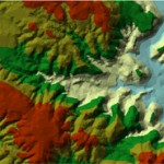
* Application of geoprocessing techniques for the generation of own thematic cartography, from the current cartography, field data and teledetection.
* Creation of mathematical multifactor models for its application in territorial analysis.
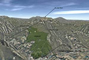
* 3D modeling for the projects on real scenarios, which allows a visualization evaluation on the change generated by the works and actions.
* Treatment of geographical information. Setting of spatial databases easy to visualize, access and update.
Cartography
 To the extent that GIS and remote sensing methods evolve, the development of specific mapping requires data processing systems complex and powerful (GIS software) at the time that technicians have to be able to handle them.
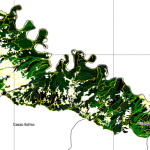
From mapping techniques (from Greek language chartis = map and graphein = writing) spatial data are represented in a clear and practical, as an essential support to decision making and project implementation.
Services offered by BALMA:
BALMA Consulting offers the following services, particularly to municipalities:
- Contracts for technical assistance for the development of thematic mapping.
- Professional edition of maps by combining the potential of GIS and Autocad.
- Help desk telephone and face to face to resolve doubts about the use of GIS.